By P.T. Bopanna

In its report to the Union government, Karnataka government claimed that the landslides were caused due to full storage in the four dams in Karnataka following heavy rains in the Cauvery catchment areas.
Such blatant lies in the report amounts to adding insult to the injuries suffered by the people of Kodagu due to landslides and the rain havoc caused mainly on account of the looting of the forest wealth in the hill district by the Kerala timber mafia backed by politicians of all shades, including the BJP.
A Times of India (TOI) report said as part of its 137 page report submitted to the Centre and the prime minister, the Karnataka government said: “The heavy rainfall and huge amount of water released from the reservoirs flowing in the downstream channels – some of them running parallel to the roads, scooped the area by causing landslides in the adjoining hills and severe damage to roads and buildings in the area.”
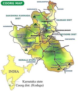
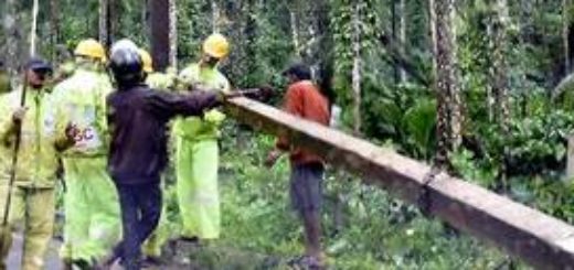
The TOI report quotes a geologist as saying that the landslides were ‘man made’ and primarily caused by the looting of the Kodagu forests by timber mafia.
In the circumstances, the JD (S)-Congress government headed by chief minister H.D. Kumaraswamy should submit a fresh report citing scientific reasons for the calamity in Kodagu, instead of misleading the prime minister with a falsified report.



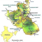









We should present the truth to PMO to open his eyes. It can also be presented through Dr Subramanya swamy.
The records maintained at HARANGI Dam, the only Dam in Kodagu District border will speak the truth. Impounding of water for a longer period in the said Dam stretched water from Garaganduru up to foot of Abbey falls ( Madapua, Hattihole, Mukkodlu, Makkanduru) and the heavy rain fall like cloud burst on 15th 16th, added to the effect of Earthquake tremor occured on July 9th has caused the land slides on the up stream side of Harangi catchment area. The damages and inconveniences caused on the down stream side in Huduguru, Kudige, Kanive and Kushalnagar town is due to letting heavy water from the Dam during excess in flow of rain water. The damages caused on Payaswini water shed areas on the slopes around Madikeri in Stuart hill, Stone hills, Nishani Hills, Galibeedu, Made, Jodupala ,Monnangeri, Kadam kal & Sampaje RF hills of western ghat caused the damages to houses and Roads in Sampaje hobli.